




L'Ardéchoise
Straßenradsport über 27 km bis 626 km mit bis zu 11.395 Hm in Saint-Félicien (Auvergne-Rhône-Alpes, Frankreich)
 Saint-Félicien, Auvergne-Rhône-Alpes, FrankreichAuf der Karte anzeigen(45.0860° N, 4.6274° E)
L'Ardéchoise ist eine Sportveranstaltung in Saint-Félicien (Auvergne-Rhône-Alpes, FR) mit Schwerpunkt auf Radsport (Straße). Charakteristische Merkmale sind Waldlauf, Berglauf, Natur & Gelände, Kinder- & Jugendläufe.
Das Wettbewerbsprogramm umfasst 54 Wettbewerbe, darunter Méridionale - Montagne Ardéchoise (626 km, +11.395 Hm), Gorges - Montagne Ardéchoise (603 km, +11.150 Hm), Gorges - Montagne Ardéchoise - Lignon (601 km, +10.445 Hm), Gorges - Pas du Loup - Sucs - Lignon (561 km, +9.455 Hm), Gorges - Tanargue - Lignon (537 km, +9.260 Hm) sowie Méridionale - Pas du Loup - 4 Jours (531 km, +9.240 Hm) (insgesamt 54 Wettbewerbe). Die nächste Ausgabe ist offiziell für den Zeitraum vom 9. Juni 2027 bis zum 12. Juni 2027 bestätigt. Aktuelle Ausschreibungsdetails, Streckeninformationen und Anmeldeoptionen stellt der Veranstalter auf der offiziellen Website (ardechoise.com) bereit.
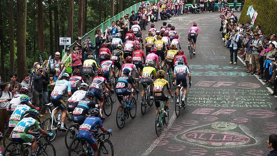
Merkmale & Streckencharakter
Wettbewerbe & Distanzen (54)
| Wettbewerb | Disziplin | Distanz | Höhenmeter | Höhenbereich | Streckenart | Strecke & Profil |
|---|---|---|---|---|---|---|
| Méridionale - Montagne Ardéchoise | Radsport (Straße) | 626 km | +11.395 Hm | 467 m - 5.253 m | Rundkurs | Strecke & Höhenprofil |
| Gorges - Montagne Ardéchoise | Radsport (Straße) | 603 km | +11.150 Hm | 470 m - 5.153 m | Rundkurs | Strecke & Höhenprofil |
| Gorges - Montagne Ardéchoise - Lignon | Radsport (Straße) | 601 km | +10.445 Hm | 473 m - 4.860 m | Rundkurs | Strecke & Höhenprofil |
| Gorges - Pas du Loup - Sucs - Lignon | Radsport (Straße) | 561 km | +9.455 Hm | 476 m - 4.447 m | Rundkurs | Strecke & Höhenprofil |
| Gorges - Tanargue - Lignon | Radsport (Straße) | 537 km | +9.260 Hm | 479 m - 4.368 m | Rundkurs | Strecke & Höhenprofil |
| Méridionale - Pas du Loup - 4 Jours | Radsport (Straße) | 531 km | +9.240 Hm | 467 m - 4.348 m | Rundkurs | Strecke & Höhenprofil |
| Méridionale - Pas du Loup | Radsport (Straße) | 515 km | +9.210 Hm | 470 m - 4.338 m | Rundkurs | Strecke & Höhenprofil |
| Gorges - Pas du Loup | Radsport (Straße) | 507 km | +9.000 Hm | 473 m - 4.253 m | Rundkurs | Strecke & Höhenprofil |
| Gorges - Ardèche | Radsport (Straße) | 485 km | +8.805 Hm | 476 m - 4.174 m | Rundkurs | Strecke & Höhenprofil |
| Gorges - Ardèche - 3 Jours | Radsport (Straße) | 469 km | +8.765 Hm | 479 m - 4.160 m | Rundkurs | Strecke & Höhenprofil |
| Kastanie - Hohe Länder - Lignon | Radsport (Straße) | 429 km | +7.740 Hm | 467 m - 3.718 m | Rundkurs | Strecke & Höhenprofil |
| Kastanie - AVM | Radsport (Straße) | 396 km | +7.890 Hm | 470 m - 3.784 m | Rundkurs | Strecke & Höhenprofil |
| Kastanie - AVM - Lignon | Radsport (Straße) | 393 km | +7.185 Hm | 473 m - 3.491 m | Rundkurs | Strecke & Höhenprofil |
| Kastanie - Loire | Radsport (Straße) | 377 km | +7.280 Hm | 476 m - 3.534 m | Rundkurs | Strecke & Höhenprofil |
| Kämme - Hochland | Radsport (Straße) | 367 km | +7.435 Hm | 479 m - 3.602 m | Rundkurs | Strecke & Höhenprofil |
| Kämme - Hochländer - Lignon | Radsport (Straße) | 364 km | +6.730 Hm | 467 m - 3.294 m | Rundkurs | Strecke & Höhenprofil |
| Kastanie - Ardéchoise | Radsport (Straße) | 340 km | +6.725 Hm | 470 m - 3.294 m | Rundkurs | Strecke & Höhenprofil |
| Hermitage - Galaure - Pilat | Radsport (Straße) | 319 km | +5.400 Hm | 473 m - 2.741 m | Rundkurs | Strecke & Höhenprofil |
| Kämme - Loire | Radsport (Straße) | 312 km | +6.270 Hm | 476 m - 3.109 m | Rundkurs | Strecke & Höhenprofil |
| Kämme - AVM | Radsport (Straße) | 298 km | +6.090 Hm | 479 m - 3.037 m | Rundkurs | Strecke & Höhenprofil |
| Kämme - AVM - Lignon | Radsport (Straße) | 295 km | +5.380 Hm | 467 m - 2.727 m | Rundkurs | Strecke & Höhenprofil |
| Loire - 2 jours | Radsport (Straße) | 291 km | +5.765 Hm | 470 m - 2.891 m | Rundkurs | Strecke & Höhenprofil |
| AVM | Radsport (Straße) | 285 km | +5.750 Hm | 473 m - 2.888 m | Rundkurs | Strecke & Höhenprofil |
| AVM-2 Tage | Radsport (Straße) | 276 km | +5.585 Hm | 476 m - 2.822 m | Rundkurs | Strecke & Höhenprofil |
| Crêtes - Sucs | Radsport (Straße) | 253 km | +5.000 Hm | 479 m - 2.579 m | Rundkurs | Strecke & Höhenprofil |
| Crêtes - Sucs - Lignon | Radsport (Straße) | 251 km | +4.290 Hm | 467 m - 2.269 m | Rundkurs | Strecke & Höhenprofil |
| Kämme - Ardéchoise | Radsport (Straße) | 242 km | +4.925 Hm | 470 m - 2.538 m | Rundkurs | Strecke & Höhenprofil |
| Sucs (241 km) | Radsport (Straße) | 241 km | +4.660 Hm | 473 m - 2.430 m | Rundkurs | Strecke & Höhenprofil |
| Sucs - 2 Jours | Radsport (Straße) | 233 km | +4.495 Hm | 476 m - 2.364 m | Rundkurs | Strecke & Höhenprofil |
| Sucs (232 km) | Radsport (Straße) | 232 km | +4.425 Hm | 479 m - 2.337 m | Rundkurs | Strecke & Höhenprofil |
| Ardéchoise (230 km) | Radsport (Straße) | 230 km | +4.585 Hm | 467 m - 2.393 m | Rundkurs | Strecke & Höhenprofil |
| Sucs Lignon - 2 jours | Radsport (Straße) | 230 km | +3.790 Hm | 470 m - 2.062 m | Rundkurs | Strecke & Höhenprofil |
| Ardéchoise (221 km) | Radsport (Straße) | 221 km | +4.415 Hm | 473 m - 2.327 m | Rundkurs | Strecke & Höhenprofil |
| Ardéchoise - 2 Tage | Radsport (Straße) | 221 km | +4.415 Hm | 476 m - 2.330 m | Rundkurs | Strecke & Höhenprofil |
| Kämme - Eyrieux - Lignon | Radsport (Straße) | 212 km | +3.680 Hm | 479 m - 2.025 m | Rundkurs | Strecke & Höhenprofil |
| Pilat - 2 Jours | Radsport (Straße) | 192 km | +3.550 Hm | 467 m - 1.958 m | Rundkurs | Strecke & Höhenprofil |
| Volcanique (186 km) | Radsport (Straße) | 186 km | +3.495 Hm | 470 m - 1.938 m | Rundkurs | Strecke & Höhenprofil |
| Volcanique - 2 Jours | Radsport (Straße) | 177 km | +3.330 Hm | 473 m - 1.872 m | Rundkurs | Strecke & Höhenprofil |
| Volcanique (177 km) | Radsport (Straße) | 177 km | +3.260 Hm | 476 m - 1.845 m | Rundkurs | Strecke & Höhenprofil |
| Monts d'Ardèche | Radsport (Straße) | 167 km | +3.140 Hm | 479 m - 1.798 m | Rundkurs | Strecke & Höhenprofil |
| Haut Vivarais - 2 jours | Radsport (Straße) | 162 km | +2.680 Hm | 467 m - 1.593 m | Rundkurs | Strecke & Höhenprofil |
| Monts d’Ardèche | Radsport (Straße) | 157 km | +2.970 Hm | 470 m - 1.717 m | Rundkurs | Strecke & Höhenprofil |
| Boutières (134 km) | Radsport (Straße) | 134 km | +2.470 Hm | 473 m - 1.510 m | Rundkurs | Strecke & Höhenprofil |
| Pays d’Ay - Hermitage | Radsport (Straße) | 130 km | +1.780 Hm | 476 m - 1.224 m | Rundkurs | Strecke & Höhenprofil |
| Boutières-2 Tage | Radsport (Straße) | 126 km | +2.300 Hm | 479 m - 1.445 m | Rundkurs | Strecke & Höhenprofil |
| Boutières (125 km) | Radsport (Straße) | 125 km | +2.300 Hm | 467 m - 1.433 m | Rundkurs | Strecke & Höhenprofil |
| Haut Vivarais - Pays d’Ay | Radsport (Straße) | 122 km | +1.995 Hm | 470 m - 1.308 m | Rundkurs | Strecke & Höhenprofil |
| Krebs | Radsport (Straße) | 106 km | +1.930 Hm | 473 m - 1.284 m | Rundkurs | Strecke & Höhenprofil |
| Doux | Radsport (Straße) | 85 km | +1.480 Hm | 476 m - 1.098 m | Rundkurs | Strecke & Höhenprofil |
| Rhône | Radsport (Straße) | 66 km | +810 Hm | 479 m - 819 m | Rundkurs | Strecke & Höhenprofil |
| ADJ Nord - Adler | Radsport (Straße) | 51 km | +880 Hm | 467 m - 837 m | Rundkurs | Strecke & Höhenprofil |
| ADJ Süd - Fuchs | Radsport (Straße) | 39 km | +715 Hm | 470 m - 770 m | Rundkurs | Strecke & Höhenprofil |
| ADJ Nord - Eichhörnchen | Radsport (Straße) | 30 km | +440 Hm | 473 m - 658 m | Rundkurs | Strecke & Höhenprofil |
| ADJ Süd - Frosch | Radsport (Straße) | 27 km | +310 Hm | 476 m - 606 m | Rundkurs | Strecke & Höhenprofil |
Streckenverlauf & Karte
Höhenprofil & Streckentelemetrie
Seehöhe von 467 m bis 5.253 m ü. NHN (+11.395 Hm, -11.395 Hm)
Höhenprofil & Streckentelemetrie
Seehöhe von 470 m bis 5.153 m ü. NHN (+11.150 Hm, -11.150 Hm)
Höhenprofil & Streckentelemetrie
Seehöhe von 473 m bis 4.860 m ü. NHN (+10.445 Hm, -10.445 Hm)
Höhenprofil & Streckentelemetrie
Seehöhe von 476 m bis 4.447 m ü. NHN (+9.455 Hm, -9.455 Hm)
Höhenprofil & Streckentelemetrie
Seehöhe von 479 m bis 4.368 m ü. NHN (+9.260 Hm, -9.260 Hm)
Höhenprofil & Streckentelemetrie
Seehöhe von 467 m bis 4.348 m ü. NHN (+9.240 Hm, -9.240 Hm)
Höhenprofil & Streckentelemetrie
Seehöhe von 470 m bis 4.338 m ü. NHN (+9.210 Hm, -9.210 Hm)
Höhenprofil & Streckentelemetrie
Seehöhe von 473 m bis 4.253 m ü. NHN (+9.000 Hm, -9.000 Hm)
Höhenprofil & Streckentelemetrie
Seehöhe von 476 m bis 4.174 m ü. NHN (+8.805 Hm, -8.805 Hm)
Höhenprofil & Streckentelemetrie
Seehöhe von 479 m bis 4.160 m ü. NHN (+8.765 Hm, -8.765 Hm)
Höhenprofil & Streckentelemetrie
Seehöhe von 467 m bis 3.718 m ü. NHN (+7.740 Hm, -7.740 Hm)
Höhenprofil & Streckentelemetrie
Seehöhe von 470 m bis 3.784 m ü. NHN (+7.890 Hm, -7.890 Hm)
Höhenprofil & Streckentelemetrie
Seehöhe von 473 m bis 3.491 m ü. NHN (+7.185 Hm, -7.185 Hm)
Höhenprofil & Streckentelemetrie
Seehöhe von 476 m bis 3.534 m ü. NHN (+7.280 Hm, -7.280 Hm)
Höhenprofil & Streckentelemetrie
Seehöhe von 479 m bis 3.602 m ü. NHN (+7.435 Hm, -7.435 Hm)
Höhenprofil & Streckentelemetrie
Seehöhe von 467 m bis 3.294 m ü. NHN (+6.730 Hm, -6.730 Hm)
Höhenprofil & Streckentelemetrie
Seehöhe von 470 m bis 3.294 m ü. NHN (+6.725 Hm, -6.725 Hm)
Höhenprofil & Streckentelemetrie
Seehöhe von 473 m bis 2.741 m ü. NHN (+5.400 Hm, -5.400 Hm)
Höhenprofil & Streckentelemetrie
Seehöhe von 476 m bis 3.109 m ü. NHN (+6.270 Hm, -6.270 Hm)
Höhenprofil & Streckentelemetrie
Seehöhe von 479 m bis 3.037 m ü. NHN (+6.090 Hm, -6.090 Hm)
Höhenprofil & Streckentelemetrie
Seehöhe von 467 m bis 2.727 m ü. NHN (+5.380 Hm, -5.380 Hm)
Höhenprofil & Streckentelemetrie
Seehöhe von 470 m bis 2.891 m ü. NHN (+5.765 Hm, -5.765 Hm)
Höhenprofil & Streckentelemetrie
Seehöhe von 473 m bis 2.888 m ü. NHN (+5.750 Hm, -5.750 Hm)
Höhenprofil & Streckentelemetrie
Seehöhe von 476 m bis 2.822 m ü. NHN (+5.585 Hm, -5.585 Hm)
Höhenprofil & Streckentelemetrie
Seehöhe von 479 m bis 2.579 m ü. NHN (+5.000 Hm, -5.000 Hm)
Höhenprofil & Streckentelemetrie
Seehöhe von 467 m bis 2.269 m ü. NHN (+4.290 Hm, -4.290 Hm)
Höhenprofil & Streckentelemetrie
Seehöhe von 470 m bis 2.538 m ü. NHN (+4.925 Hm, -4.925 Hm)
Höhenprofil & Streckentelemetrie
Seehöhe von 473 m bis 2.430 m ü. NHN (+4.660 Hm, -4.660 Hm)
Höhenprofil & Streckentelemetrie
Seehöhe von 476 m bis 2.364 m ü. NHN (+4.495 Hm, -4.495 Hm)
Höhenprofil & Streckentelemetrie
Seehöhe von 479 m bis 2.337 m ü. NHN (+4.425 Hm, -4.425 Hm)
Höhenprofil & Streckentelemetrie
Seehöhe von 467 m bis 2.393 m ü. NHN (+4.585 Hm, -4.585 Hm)
Höhenprofil & Streckentelemetrie
Seehöhe von 470 m bis 2.062 m ü. NHN (+3.790 Hm, -3.790 Hm)
Höhenprofil & Streckentelemetrie
Seehöhe von 473 m bis 2.327 m ü. NHN (+4.415 Hm, -4.415 Hm)
Höhenprofil & Streckentelemetrie
Seehöhe von 476 m bis 2.330 m ü. NHN (+4.415 Hm, -4.415 Hm)
Höhenprofil & Streckentelemetrie
Seehöhe von 479 m bis 2.025 m ü. NHN (+3.680 Hm, -3.680 Hm)
Höhenprofil & Streckentelemetrie
Seehöhe von 467 m bis 1.958 m ü. NHN (+3.550 Hm, -3.550 Hm)
Höhenprofil & Streckentelemetrie
Seehöhe von 470 m bis 1.938 m ü. NHN (+3.495 Hm, -3.495 Hm)
Höhenprofil & Streckentelemetrie
Seehöhe von 473 m bis 1.872 m ü. NHN (+3.330 Hm, -3.330 Hm)
Höhenprofil & Streckentelemetrie
Seehöhe von 476 m bis 1.845 m ü. NHN (+3.260 Hm, -3.260 Hm)
Höhenprofil & Streckentelemetrie
Seehöhe von 479 m bis 1.798 m ü. NHN (+3.140 Hm, -3.140 Hm)
Höhenprofil & Streckentelemetrie
Seehöhe von 467 m bis 1.593 m ü. NHN (+2.680 Hm, -2.680 Hm)
Höhenprofil & Streckentelemetrie
Seehöhe von 470 m bis 1.717 m ü. NHN (+2.970 Hm, -2.970 Hm)
Höhenprofil & Streckentelemetrie
Seehöhe von 473 m bis 1.510 m ü. NHN (+2.470 Hm, -2.470 Hm)
Höhenprofil & Streckentelemetrie
Seehöhe von 476 m bis 1.224 m ü. NHN (+1.780 Hm, -1.780 Hm)
Höhenprofil & Streckentelemetrie
Seehöhe von 479 m bis 1.445 m ü. NHN (+2.300 Hm, -2.300 Hm)
Höhenprofil & Streckentelemetrie
Seehöhe von 467 m bis 1.433 m ü. NHN (+2.300 Hm, -2.300 Hm)
Höhenprofil & Streckentelemetrie
Seehöhe von 470 m bis 1.308 m ü. NHN (+1.995 Hm, -1.995 Hm)
Höhenprofil & Streckentelemetrie
Seehöhe von 473 m bis 1.284 m ü. NHN (+1.930 Hm, -1.930 Hm)
Höhenprofil & Streckentelemetrie
Seehöhe von 476 m bis 1.098 m ü. NHN (+1.480 Hm, -1.480 Hm)
Höhenprofil & Streckentelemetrie
Seehöhe von 479 m bis 819 m ü. NHN (+810 Hm, -810 Hm)
Höhenprofil & Streckentelemetrie
Seehöhe von 467 m bis 837 m ü. NHN (+880 Hm, -880 Hm)
Höhenprofil & Streckentelemetrie
Seehöhe von 470 m bis 770 m ü. NHN (+715 Hm, -715 Hm)
Höhenprofil & Streckentelemetrie
Seehöhe von 473 m bis 658 m ü. NHN (+440 Hm, -440 Hm)
Höhenprofil & Streckentelemetrie
Seehöhe von 476 m bis 606 m ü. NHN (+310 Hm, -310 Hm)
Häufig gestellte Fragen (FAQ)
Wann und wo findet L'Ardéchoise statt?
L'Ardéchoise wird in Saint-Félicien (Auvergne-Rhône-Alpes, FR) ausgetragen (Startbereich bei den Koordinaten 45,086° N, 4,6274° O). Die nächste Ausgabe ist offiziell für den Zeitraum vom 9. Juni 2027 bis zum 12. Juni 2027 bestätigt.
Welche Wettbewerbe und Distanzen gibt es bei L'Ardéchoise?
Das Wettbewerbsprogramm umfasst 54 Wettbewerbe, darunter Méridionale - Montagne Ardéchoise (626 km, +11.395 Hm), Gorges - Montagne Ardéchoise (603 km, +11.150 Hm), Gorges - Montagne Ardéchoise - Lignon (601 km, +10.445 Hm), Gorges - Pas du Loup - Sucs - Lignon (561 km, +9.455 Hm), Gorges - Tanargue - Lignon (537 km, +9.260 Hm) sowie Méridionale - Pas du Loup - 4 Jours (531 km, +9.240 Hm) (insgesamt 54 Wettbewerbe). Die Wettbewerbe gehören zur Disziplin Radsport (Straße).
Wie verläuft die Strecke und wie sieht das Höhenprofil bei L'Ardéchoise aus?
Der Hauptwettbewerb (Méridionale - Montagne Ardéchoise über 626 km) ist als Rundkurs konzipiert und weist +11.395 Hm Anstieg sowie -11.395 Hm Abstieg auf. Der Kurs bewegt sich auf einer Seehöhe zwischen 467 m und 5.253 m. Eine interaktive Streckenkarte mit Streckenverlauf, Höhenprofil und GPX-Export steht im Streckenbereich auf dieser Seite bereit.
Wo finde ich Anmeldung und offizielle Ausschreibung für L'Ardéchoise?
Aktuelle Ausschreibungsdetails, Streckeninformationen und Anmeldeoptionen stellt der Veranstalter auf der offiziellen Website (ardechoise.com) bereit.