



Salland Trail
Trail Running covering 12 km to 100 km in Nijverdal (Overijssel, Netherlands)
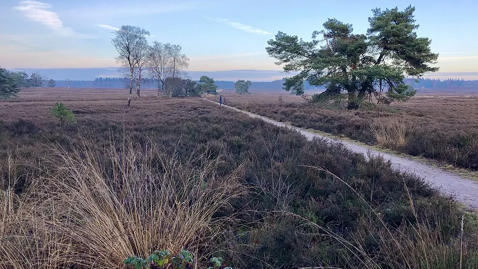
Salland Trail is an endurance sporting event in Nijverdal, Overijssel, NL focused on Trail Running. Key features include Nature & Off-Road, Forest.
The race program comprises 9 competitions, including Trail 100 km (100 km, +2,600 m D+), Trail 80 km (80 km, +2,080 m D+), Trail 60 km (60 km, +1,560 m D+), Trail 50 km (50 km, +1,300 m D+), Trail 42 km (42 km, +1,092 m D+), and Trail 36 km (36 km, +936 m D+) (9 competitions in total). The next edition is officially confirmed for March 6, 2027. Official race regulations, course details, and registration information are provided on the organizer's website (sallandtrail.nl).
Event characteristics
Races & distances (9)
| Competition | Discipline | Distance | Elevation gain | Altitude range | Course type | Course & profile |
|---|---|---|---|---|---|---|
| Trail 100 km | Trail Running | 100 km | +2,600 m | 18 m - 1,110 m | Loop course | Route & profile |
| Trail 80 km | Trail Running | 80 km | +2,080 m | 21 m - 895 m | Loop course | Route & profile |
| Trail 60 km | Trail Running | 60 km | +1,560 m | 24 m - 679 m | Loop course | Route & profile |
| Trail 50 km | Trail Running | 50 km | +1,300 m | 27 m - 573 m | Loop course | Route & profile |
| Trail 42 km | Trail Running | 42 km | +1,092 m | 30 m - 489 m | Loop course | Route & profile |
| Trail 36 km | Trail Running | 36 km | +936 m | 18 m - 411 m | Loop course | Route & profile |
| Trail 30 km | Trail Running | 30 km | +780 m | 21 m - 349 m | Loop course | Route & profile |
| Trail 21 km | Trail Running | 21 km | +546 m | 24 m - 253 m | Loop course | Route & profile |
| Trail 12 km | Trail Running | 12 km | +312 m | 27 m - 158 m | Loop course | Route & profile |
Course route & map
Elevation profile & course telemetry
Altitude from 18 m to 1,110 m above sea level (+2,600 m D+, -2,600 m D-)
Elevation profile & course telemetry
Altitude from 21 m to 895 m above sea level (+2,080 m D+, -2,080 m D-)
Elevation profile & course telemetry
Altitude from 24 m to 679 m above sea level (+1,560 m D+, -1,560 m D-)
Elevation profile & course telemetry
Altitude from 27 m to 573 m above sea level (+1,300 m D+, -1,300 m D-)
Elevation profile & course telemetry
Altitude from 30 m to 489 m above sea level (+1,092 m D+, -1,092 m D-)
Elevation profile & course telemetry
Altitude from 18 m to 411 m above sea level (+936 m D+, -936 m D-)
Elevation profile & course telemetry
Altitude from 21 m to 349 m above sea level (+780 m D+, -780 m D-)
Elevation profile & course telemetry
Altitude from 24 m to 253 m above sea level (+546 m D+, -546 m D-)
Elevation profile & course telemetry
Altitude from 27 m to 158 m above sea level (+312 m D+, -312 m D-)
Frequently asked questions (FAQ)
When and where does Salland Trail take place?
Salland Trail takes place in Nijverdal, Overijssel, NL (start area at coordinates 52.36° N, 6.4681° E). The next edition is officially confirmed for March 6, 2027.
What races and distances are offered at Salland Trail?
The race program comprises 9 competitions, including Trail 100 km (100 km, +2,600 m D+), Trail 80 km (80 km, +2,080 m D+), Trail 60 km (60 km, +1,560 m D+), Trail 50 km (50 km, +1,300 m D+), Trail 42 km (42 km, +1,092 m D+), and Trail 36 km (36 km, +936 m D+) (9 competitions in total). The competitions belong to Trail Running.
What is the course layout and elevation profile for Salland Trail?
The main competition (Trail 100 km over 100 km) is designed as a loop course featuring +2,600 m of elevation gain and -2,600 m of elevation loss, ranging between 18 m and 1,110 m above sea level. An interactive course map with route visualization, elevation profile, and GPX export is available in the course section on this page.
Where can I find registration and official race rules for Salland Trail?
Official race regulations, course details, and registration information are provided on the organizer's website (sallandtrail.nl).